اطلاع برائے انٹرویو
تمام انٹرویوز کمشنر قلات ڈویژن، خضدار کے دفتر میں ہوں گے
ان تمام امیدواروں کو بذریعہ اطلاعِ عام آگاہ کیا جاتا ہے جنہوں نے جنہوں نے محکمہ ریونیو قلات ڈویژن کے اسامیوں کے لیے تحریری امتحان پاس کیا ہے کہ ان کا زبانی امتحان مندرجہ ذیل شیڈول کے مطابق کمشنر قلات ڈویژن کے دفتر میں ہوگا۔ امیدواران سے گزارش ہے کہ وہ اپنے اصل کاغذات ہمراہ لائیں اور کمیٹی کے روبرو پیش ہوں۔
وقت
12:00 PM تا 3:00 PM
شیڈول
| تاریخ اور دن | اسامی | اضلاع / تحصیلیں |
|---|---|---|
| 7 نومبر 2025، بروز جمعہ | جونیئر کلرک | ضلع آواران و حب |
| 8 نومبر 2025، بروز ہفتہ | جونیئر کلرک | ضلع لسبیلہ و سوراب |
| 9 نومبر 2025، بروز اتوار | جونیئر کلرک | ضلع قلات و مستونگ |
| 10 نومبر 2025، بروز پیر | جونیئر کلرک | ضلع خضدار |
| 10 نومبر 2025 (دوپہر کے بعد) | دیگر اسامیاں | ضلع خضدار، قلات، لسبیلہ، مستونگ ,آواران، سوراب، حب |
دیگر اسامیاں
- اسسٹنٹ کمپیوٹر آپریٹر، ڈیٹا انٹری آپریٹر
- کیشئر، کیئر ٹیکر، جنریٹر آپریٹر
- فوٹو کاپی آپریٹر، فوٹو مشین آپریٹر
کمشنر / چیئرمین ریکروٹمنٹ کمیٹی
قلات ڈویژن
Interview Notice
All interviews will be held at the Office of the Commissioner, Kalat Division, Khuzdar
All candidates who have passed the written examination for posts of Revenue Department Kalat Division, are informed that their interviews (viva voce) will be conducted at the Office of the Commissioner, Kalat Division, according to the schedule below. Candidates must bring their original documents and appear before the committee.
Time
12:00 PM to 3:00 PM
Schedule
| Date and Day | Post | Districts / Tehsils |
|---|---|---|
| Friday, 7 November 2025 | Junior Clerk | District Awaran and Hub |
| Saturday, 8 November 2025 | Junior Clerk | District Lasbela and Surab |
| Sunday, 9 November 2025 | Junior Clerk | District Kalat and Mastung |
| Monday, 10 November 2025 | Junior Clerk | District Khuzdar |
| Monday, 10 November 2025 (After Noon) | Other Posts | Districts Khuzdar, Kalat, Lasbela, Mastung, Awaran, Surab, Hub |
Other Posts
- Assistant Computer Operator, Data Entry Operator
- Cashier, Caretaker, Generator Operator
- Photocopy Operator, Photo Machine Operator
Commissioner / Chair, Recruitment Committee
Kalat Division
Kalat Division Information
Kalat Division – Interactive Map
Kalat Division, located in central Balochistan, derives its name from the historic city of Kalat, which was once the capital of the Khanate of Kalat, a princely state established in the 17th century by Ahmadzai Baloch rulers. The region has long been a cultural and political hub for the Baloch people, serving as a center of power and trade along routes connecting Sindh, Iran, and Afghanistan. Under British colonial rule in the 19th century, Kalat retained a degree of autonomy as a princely state allied with the British Empire. After the independence of Pakistan in 1947, the Khan of Kalat initially sought independence but later acceded to Pakistan in March 1948, bringing the state under Pakistani administration. Over time, administrative reforms reorganized Balochistan into divisions and districts, with Kalat Division becoming one of the key divisions. Today, it encompasses several important districts including Khuzdar, Hub, Mastung, Lasbela, S.Sikander Abad (Surab), Kalat, and Awaran, retaining its historical significance as both a cultural heartland and a strategic region of Balochistan.
Kalat Division
Administrative
| Division | Kalat Division |
|---|---|
| Sub-Divisions (sum) | — |
| Tehsils | — |
| UCs (sum) | — |
Health Facilities
| Hospitals | RHCs | BHUs | CDs | MCH | School HU | Total |
|---|---|---|---|---|---|---|
| — | ||||||
Education (Schools)
| Grand Total | Functional | Non-functional |
|---|---|---|
| — | ||
Higher Education
| University | Med | Deg Boys | Deg Girls | Elem Boys | Elem Girls | Inter Boys | Inter Girls | Cadet | BRC | Poly |
|---|---|---|---|---|---|---|---|---|---|---|
| — | ||||||||||
Tip: If a field shows “—”, data isn’t available for that level.
Khuzdar is the administrative headquarters of Kalat Division and one of the largest districts in Balochistan. Historically part of the Khanate of Kalat, it has served as a strategic trade and cultural center connecting Sindh, Punjab, and interior Balochistan. The district is mountainous, with fertile valleys that support agriculture, and it is also a growing educational and administrative hub.
Hub lies on the border with Sindh and is considered the industrial and commercial gateway of Balochistan. Its proximity to Karachi has made it home to numerous factories, cement plants, and industries that drive the provincial economy. Hub also plays a vital role in trade, transport, and providing employment opportunities to thousands of people from both Balochistan and Sindh.
Mastung is known for its fertile lands and fruit orchards, producing apples, grapes, and apricots. It has long been a settlement area of Baloch tribes and is historically significant as a stop on the route to Quetta. The district is a blend of agriculture, tribal traditions, and small-scale trade, making it an important link between Quetta and the southern districts of Balochistan.
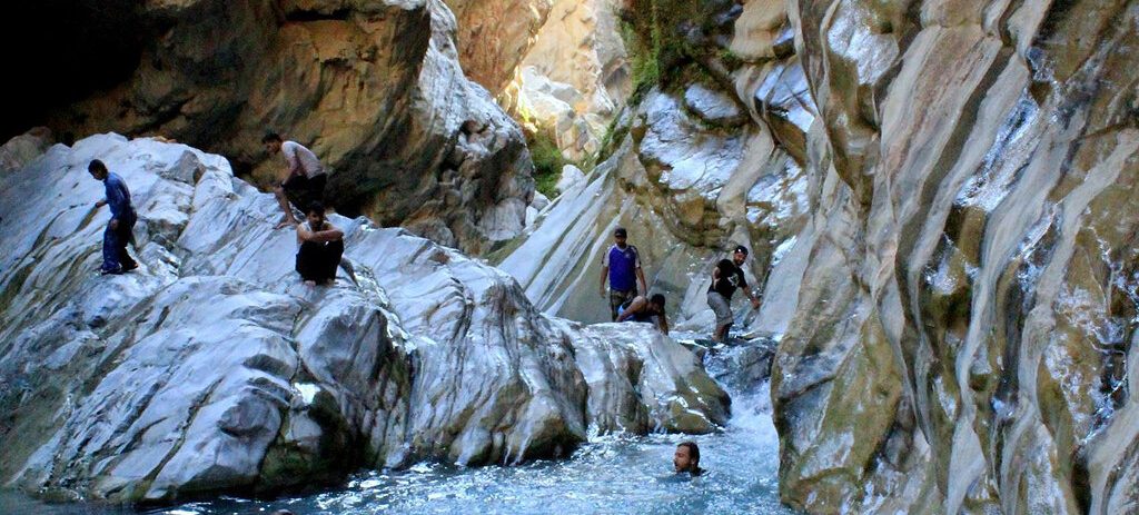
Lasbela is a district of diverse geography, combining plains, mountains, and a coastal strip along the Arabian Sea. It is home to the famous Hingol National Park, rich in wildlife and natural beauty, as well as the Hinglaj Mata temple, an important Hindu pilgrimage site. With its coastline, historical sites, and cultural diversity, Lasbela stands out as both a tourist attraction and a vital area for fisheries and trade.
Shaheed Sikandaer Abad (Surab) is a smaller district but is well known for its orchards and fertile agricultural land. It produces high-quality apples, grapes, and dates, which contribute significantly to Balochistan’s fruit economy. Surab is also a scenic region, surrounded by hills and valleys, where traditional Baloch culture and farming practices are preserved by local tribes.
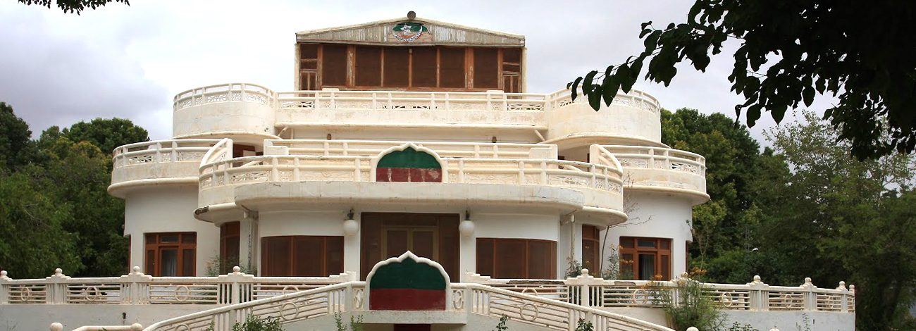
Kalat, the namesake district of the division, holds deep historical and cultural importance as the former capital of the Khanate of Kalat. It houses old forts, palaces, and remains a symbol of Baloch pride and history. The district is mountainous, with settlements scattered in valleys, and continues to be regarded as the traditional heartland of Baloch heritage and political history.
Awaran is one of the most sparsely populated districts of Balochistan, characterized by rugged mountains, desert plains, and scattered settlements. Despite facing challenges of underdevelopment and limited infrastructure, the district is known for its date farming and natural resilience. Awaran represents the tough yet enduring spirit of the Baloch people living in some of the harshest terrains of the province.
Enter your queries with complete information, name, email, phone number and the reason of your query with all necessary details.